- City Fajr Shuruq Duhr Asr Magrib Isha
- Dubai 04:32 05:49 12:21 15:48 18:47 20:04

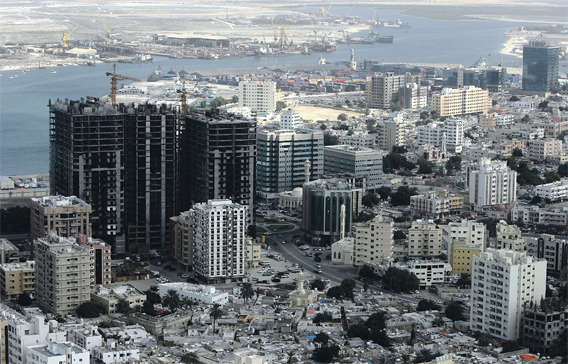
The Ajman Government has turned down some developers' proposals for projects that depend on land reclamation from the sea, because of environmental concerns. (EB FILE)
The Ajman Creek, which forms two-thirds of the emirate's waterfront, is the focus of an urban development plan that aims to attract tourists and commercial activities.
According to suggestions in the Ajman Waterfront Strategic Plan, the creek should be cleaned and used for transportation. Also among the project proposals is a tramway running along the beach and the creek, and a beach park.
The plan comes under the emirate's Urban Planning Strategy 2030 and is aimed at offering an attractive waterfront that would place the city on the tourist map and make it a desirable destination to work and live in, said Dr Ghada Mahmoud Hafez, Director of the Strategy and Plan Project, Ajman Municipality and Planning Department, during the three-day Ajman International Urban Planning Conference.
Some projects, such as the two hotels on the beach, Ajman Marina and Al Zorah, are currently under way. Other projects, such as restaurants and entertainment avenues on the beach, have been completed already, she said.
The plan, obtained by Emirates Business, suggests setting up of multi-purpose community centres and complexes and expanding streets that connect the beach with the heritage area.
"It is important to create a tourist avenue by connecting the beach – where the hotels are – with the heritage area situated behind in addition to linking the beach with the creek – which is 28km in length – by a tramway and a walkway," said Hafez. "The Industrial Free Zone, which occupies 12 per cent of the waterfront, should be turned into a multi-purpose free zone to allow commercial and tourism-related activities. Currently, only six per cent of the emirate's waterfront is under use," she said.
The Ajman Government has turned down some developers' proposals for projects that depend on land reclamation from the sea, on grounds that they may adversely affect the marine environment and deprive people of an unrestricted view of the sea. The government stressed the importance of having waterfront projects that would benefit everyone, not just the elite, she said.
However, since the Ajman coastline is shallow, land can be easily reclaimed to expand the beach and create a beachfront park and other entertainment areas to meet the needs of residents and draw tourists, Hafez added.
"The designs of the buildings and complexes on the waterfront should become landmarks in the emirate, as they will be Ajman's face to the world," said the official. "This comes under the regulations of the emirate's waterfront urban planning."
A study carried out earlier showed the misuse of waterfront land for lack of appropriate planning. Some industrial activities on the creek caused water pollution and obstructed the sea view at Mushairef area, she said. The current plan highlights the importance of re-planning the two sides of the creek for better utilisation in every way, said Hafez.
She noted that the creek, which forks out in two branches, can be used for transportation, especially as it reaches close to the city centre, which is the commercial activity hub in the emirate. The study also showed there are areas on the coastline that are isolated from the city. These areas can be linked with the city via the road network and can be used for complexes and tourism projects, said Hafez.
"At the moment, Al Safia Island is not optimally utilised. It can be turned into a prime tourist attraction, thanks to its natural splendour," she said. Ajman downtown, which is situated behind the waterfront, is a vantage point for facilitating tourist movement and it should be better linked with the waterfront by an expanded road network, said Hafez.
The plan suggests the need for bridges above the creek to connect Mushairef and Al Jurf areas with the rest of the city. Traffic congestion along the corniche should be reduced by expanding the parallel roads. It also emphasises the need to specify the heights of buildings and complexes that will come up near the waterfront.
The plan
The Ajman Waterfront Strategic Plan has divided the emirate's waterfront into six areas:
- The City Entrance
- The Downtown
- The Free Zone
- Al Safia Island
- Al Mushairef Area
- Al Zorah
![]() Follow Emirates 24|7 on Google News.
Follow Emirates 24|7 on Google News.