- City Fajr Shuruq Duhr Asr Magrib Isha
- Dubai 04:35 05:51 12:21 15:49 18:46 20:03

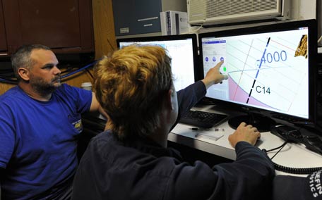
Photo: AFP
The painstaking search for missing flight MH370 has uncovered a previously unknown undersea world of volcanoes, deep valleys and soaring ridges, according to detailed maps released by Australia.
Although no trace of the Malaysia Airlines plane was found during the search in the southern Indian Ocean -- the most expensive ever of its kind -- large volumes of data showing a detailed picture of the sea floor had to be collected to guide the probe.
Scientists are hopeful the new maps will give their community greater insight into oceans.
"It is estimated that only 10 to 15 percent of the world's oceans have been surveyed with the kind of technology used in the search for MH370," Geoscience Australia's environmental geoscience chief Stuart Minchin said late Wednesday.
"(That makes) this remote part of the Indian Ocean among the most thoroughly mapped regions of the deep ocean on the planet.
"So this data is unique both because of the remote location of the search area, and because of the sheer scale of the area surveyed."
Minchin said the maps would also be useful for future scientific research, such as oceanographic and habitat modelling.
Australia, Malaysia and China suspended the deep sea hunt in January, almost three years after the Boeing 777 disappeared with 239 people on board.
The hunt - based on satellite analysis of the jet's likely trajectory after it diverted from its flight path - covered a 120,000 square-kilometre (46,000 square mile) designated zone, an area slightly smaller than England.
Two shipwrecks were discovered during the search but no trace of the plane, deepening one the most enduring mysteries of the aviation age.
However, the data revealed ridges six kilometres (3.73 miles) wide and 15 kilometres long that rise 1,500 metres above the sea floor, as well as fault valleys 1,200 metres deep and five kilometres wide.
A second set of data will be released in mid-2018.
While the search for the missing plane has been called off, Canberra has said it could be restarted if new evidence about the specific location of the aircraft emerges.
"We remain hopeful that new information will come to light and that at some point in the future the aircraft will be located," Australia's Transport Minister Darren Chester said.
Australia's national science body CSIRO released a report in April confirming that MH370 was "most likely" north of the former search zone.
Three fragments from the plane have been recovered washed up on western Indian Ocean shores, including a two-metre wing part known as a flaperon found on La Reunion island.
Speculation on the cause of the plane's disappearance has focused primarily on possible hijacking, rogue pilot action or mechanical failure, but nothing has yet been proved.
MH370 search data unveils fishing hot spots, ancient geological movements
Detailed sea-floor maps made during the unsuccessful search for missing Malaysia Airlines Flight MH370, released by Australia on Wednesday, could help increase the knowledge of rich fisheries and the prehistoric movement of the earth's southern continents.
The Indian Ocean search ended in January after covering a lonely stretch of open water where under-sea mountains larger than Mount Everest rise and a rift valley dotted with subsea volcanoes runs for hundreds of kilometres.
The whereabouts of the plane, which vanished in March 2014 en route to Beijing from Kuala Lumpur with 239 people on board, remains one of the world's greatest aviation mysteries.
However, information gathered during painstaking surveys of some 120,000 sq km (46,000 sq miles) of the remote waters west of Australia should provide fishermen, oceanographers and geologists insight into the region in unprecedented detail, said Charitha Pattiaratchi, professor of coastal oceanography at the University of Western Australia.
"There are the locations of seamounts which will attract a lot of international deep sea fishermen to the area," Pattiaratchi told Reuters by phone.
High-priced fish such as tuna, toothfish, orange roughy, alfonsino and trevally are known to gather near the seamounts, where plankton swirl in the currents.
Pattiaratchi said the location of seamounts would also help model the impact of tsunamis, given undersea mountains help dissipate their destructive energy, and potentially change our understanding of the break-up of the ancient supercontinent of Gondwana.
The data consists of three-dimensional models of undersea landforms as well as raw bathymetric survey information and drift analysis. It was published online by Geoscience Australia on Wednesday, with a further tranche due to be published next year.
"To see this work come out of that tragedy that was MH370 is really quite astounding, they've taken it to a new level," said Martin Exel, a commercial deep-sea fisherman at Austral Fisheries who has fished in the area.
"From a fishing perspective it would be valuable information - they've found whale bones and cables and a drum, it is incredible the resolution," he said, referring to the data.
But the expense and difficulty of operating in such remote high seas made a rush to fill nets in the area unlikely, he said.
Stuart Minchin, chief of Geoscience Australia's environmental geoscience division, said the remote search area was now among the most thoroughly mapped regions of the deep ocean on the planet.
"It is estimated that only 10 to 15 percent of the world's oceans have been surveyed with the kind of technology used in the search for MH370," Minchin said.
Investigators believe someone may have deliberately switched off MH370's transponder before diverting it thousands of miles off course, out over the Indian Ocean.
Various pieces of debris have been collected from Indian Ocean islands and Africa's east coast and at least three of them have been confirmed as coming from the missing Boeing 777.
Australia has not ruled out resuming the search for the airliner but has said that would depend on finding "credible new evidence" about the plane's whereabouts.
"No new information has been discovered to determine the specific location of the aircraft and the underwater search remains suspended," Transport Minister Darren Chester said in a statement.
![]() Follow Emirates 24|7 on Google News.
Follow Emirates 24|7 on Google News.