- City Fajr Shuruq Duhr Asr Magrib Isha
- Dubai 04:28 05:46 12:20 15:47 18:49 20:07

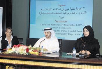
Dr Claudia Carmela Giarusso, Marine Projects Expert at DM, Alia Hamoudi, Head of Coastal Zone and Waterways Management Section, and Hamdan Al Shaer, Director of Environment Department at Dubai Municipality (SUPPLIED)
The Coastal Management section at Dubai Municipality (DM) says DM will repeat its airborne hydrographic light imaging detection and ranging (Lidar) survey techniques experience to cover the coastal zone of Dubai every two to three years. The aim is to repeatedly track changes in the coastline due to the massive coastal developments. And the project costs is Dh6 million.
Dr Claudia Carmela Giarusso, Marine projects expert at DM, said coastal erosion was taking place even before the projects existed.
"Our duties related to the coastal zone were defined in Decree 22 issued in 2001 when the coastal line was defined as one kilometre inland and 10 nautical miles seaward. When we started our monitoring in 2002, the collection of data involved various methods and enhancing our marine database in relation to all the new projects," she said. "The coastal erosion issues did not start due to the offshore islands. What these islands are doing is that they are changing the status of the beach and we are looking at these changes and coping up with them. In 2003, data showed there was no construction of The World and Palm Jumeirah Beach was still in the future. It was due to the natural inclination of the beach that erosion was present due to the presence of coastal structures. If you understand this, you can adapt, mitigate and nourish the area."
In 2004, the coastline was already suffering from erosion and some offshore breakwaters were constructed to protect the coastline, she said. To nourish beach areas, mitigate erosion and enhance the beach, the solution was to use sand from construction sites. "We used a soft solution of nourishment, which involved using around 400,000 cubic metres of sand from construction sites to nourish the coastal zone, instead of dredging. We do quality checks to ensure it is not contaminated at the DM laboratory," she said. "We co-ordinate closely with contractors and keep track of how much sand is received and used."
The coastal area is divided into 13 segments and each area is covered twice a year said Giarusso. "We have surveyed 980sqkm with near shore high density area of 160sqkm. We also have a daily report from our inspection teams and assess and compare it with satellite data in order to assess the coastal changes," she said. "We have also classified the sea-bed, created a map and gathered information on the coral. The Lidar is in the green light spectrum and is safe to use. It does not have any effects on marine or human life."
Between 2004 to 2008, the beaches of Dubai have improved with the continuous efforts of the DM, she added. "We also designed the shape of the beaches and the cross-shore profile as an additional measure in our mitigation efforts," she said. The Lidar is thus used as a decision-making tool to monitor the projects and plan, design, construct any coastal structure in mitigation, she added.
She was speaking at the DM-organised seminar, which outlined its experience using Lidar techniques. The first survey was undertaken in 2004 and as a follow up to provide a detailed snapshot of the coastal bathymetry. The project was completed in 2008.
"We are planning for longer term mitigation schemes. For instance, last year a shamal resulted in erosion, but we took urgent action and implemented solutions to ensure safety of people around that area. We tried to enhance public beaches for recreational purposes," said Giarusso.
"In 2005, following numerical modelling studies, we started the protection scheme and added new breakwater schemes to complement the nourishment schemes. For instance, near the Wollongong Beach, we detected severe erosion on the beach and took measures. Our solutions were very soft; we used groynes made from sand bags. "
The seminar, which was attended by consultants from the industry and academics, elaborated on other techniques followed by the Municipality for its coastal monitoring programme.
"We surveyed near shore and offshore areas to collect data and build up a marine database. Once of the great advantages of Lidar is its ability to survey a large area of the coastal zone compared to the huge amounts of time consumed using the traditional methods of surveying," said Hamdan Al Shaer, Director of the Environment Department. "Apart from other regular methods, we intend to repeat the Lidar project every two to three years to track the changes on the coastal line and the Gulf due to the massive developments that have occurred in the coastal zone."
![]() Follow Emirates 24|7 on Google News.
Follow Emirates 24|7 on Google News.