'Super El Niño' explained, and how it will affect the weather
Learn what a “super El Niño” is as Pacific temperatures surge to record highs, and how it could fuel floods, droughts, extreme heat, crop losses and rising heat-related deaths worldwide through 2027
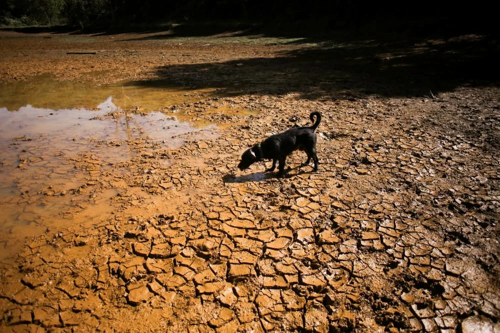
BRUSSELS: The El Niño weather pattern developing in the Pacific Ocean could be one of the strongest on record, with the potential to cause floods, droughts, extreme heat and crop losses across the world.
The phenomenon, which the World Meteorological Organization expects to reach peak intensity by early 2027, could result in 451,000 excess deaths by February, the University of Chicago's Climate Impact Lab said on Wednesday.
Here's what you need to know.
What is El Nino?
El Niño is the warm phase of the naturally occurring El Niño-Southern Oscillation cycle, a climate pattern that influences weather around the world.
It tends to cause higher global temperatures and disrupt rainfall pattens across large regions - meaning drought in some areas and heavy rains in others.
El Niño typically occurs every two to seven years, when weakening trade winds result in warmer waters in the eastern Pacific.
What makes an El Nino Super?
Elevated Pacific Ocean temperatures are the telltale sign that El Niño is forming.
This month equatorial Pacific sea surface temperatures hit 3.05 degrees Celsius (5.49 Fahrenheit) above normal levels - the highest temperature anomaly for any El Niño since records began, and far above the 0.5°C threshold for defining the phenomenon, data from the US National Oceanic and Atmospheric Administration, or NOAA, showed.
The government agency formally declared El Niño conditions had begun in June.
Equatorial Pacific temperatures of 0.5°C above the norm constitute a weak El Niño, versus 1.0°C for a moderate one, 1.5°C for a strong one, and 2.0°C for a very strong one, according to NOAA.
The WMO does not officially use the term super, but forecast this month that the developing El Niño will intensify into "a very strong event" with significant impacts on rainfall and temperatures.
The last strong El Niño in 2023 to 2024, combined with climate change, pushed 2024 to become the planet's hottest year on record. That year, Bolivia and Venezuela suffered disastrous fires, torrential floods hit Nepal, Sudan and Spain, and heatwaves in Mexico and Saudi Arabia killed thousands.
Is El Nino linked to climate change?
El Niño is a natural climate pattern and is not caused by climate change.
However, global warming can make El Niños more intense. Greenhouse gas emissions have increased the planet's average temperature by around 1.4C since pre-industrial times.
That higher baseline supercharges the effects of El Niño - enabling higher temperature spikes, more intense droughts, rains and the resulting disasters, including bushfires, floods and crop failures.
Some scientists have said the destruction likely from this year's El Niño could provide a foretaste of extremes that will become the norm in the coming decades even without an El Niño, as a result of human-caused global warming.
What to expect from this El Nino?
The combination of climate change and El Niño has led the WMO to warn that 2027 could be the hottest year since records began.
Of the 451,000 excess heat-related deaths that the coming El Niño could cause, Nigeria is expected to suffer 31,400, followed by Indonesia with 19,300 and Sudan with 17,600, the Climate Impact Lab said.
Emergency response efforts, including early warning systems and protection for outdoor workers, could save tens of thousands of these lives, the researchers said.
Typically, regions such as southern South America and parts of Central Asia get more rain in an El Niño, which can trigger disastrous flooding. In 2024, floods in Rio Grande do Sul in Brazil killed more than 180 people and displaced 600,000.
Southern Africa, Central America and Australia tend to dry out, with potentially severe consequences for crop yields and energy production from hydropower. Rice exporters expect the harvest in India, the world's top producer, to decline this year by the most since 2009 to 2010, when an El Niño-induced drought curtailed production.
Nearly 50 million people are at risk of acute hunger by the end of 2027 as a result of the developing El Nino, with southern Africa and South America among the worst-hit regions, according to U.N. World Food Programme forecasts.
El Niño also intensifies heatwaves, including in regions far from the Pacific, such as Europe, and tends to increase hurricane activity in the central and eastern Pacific ocean.